|
By 2041, the Indian state of Maharashtra will see 71 villages along the Mumbai-Pune Expressway accommodate around one million people, representing an increase of 900%.
Khatib & Alami (K&A), in partnership with Feedback Infra, is leading the formulation of an urban development framework for 71 villages along the MumbaiPune Expressway, which will help local authorities manage anticipated population rises in Maharashtra, India’s secondmost populous state.
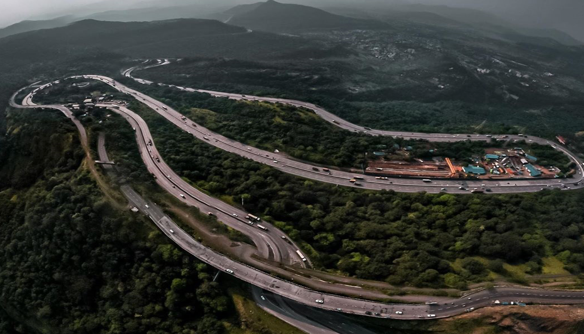
With current population trends in the Mumbai region and major infrastructure projects such as the Mumbai-Pune Expressway, Navi Mumbai International airport, and Jawaharlal Nehru Port spurring investment, approximately 4.5 million jobs are expected to be created in the project area by 2041, it will also see a corresponding 900% rise in its population to around one million residents. This important project is expected to ease pressure on neighboring Mumbai, Navi Mumbai, and Pune to provide land for housing. It is located 45km from regional capital Mumbai and 80km from Pune, both of which are accessible via the Mumbai Pune-Expressway, which passes through the entire length of the project area.
Bangalore-based project manager, Vidya Udayan Murali, said: “By envisioning the project area as a future international destination, we are supporting Maharashtra State Road Development Corporation in delivering a project that will be truly transformative for the region.
“The project will offer a high quality of life for residents, foster social inclusion and economic competitiveness and support environmental sustainability and protection. “K&A has undertaken vision formulation and concept designs, development plan formulation, preparation of development control regulations and urban design guidelines. Throughout this project, we have facilitated the newly formed local development authority to steer the policies to guide the growth and impart a judicious and environmentally-sensitive development with optimization of resources.”
AN INTEGRATED APPROACH TO SUSTAINABLE DEVELOPMENT PLANNING AND IMPLEMENTATION
When the project started, the area was guided by two authorized regional plans, the Mumbai Metropolitan Region (MMR) Plan (2016-2036) and Raigad Regional Plan (notified in 1991). The challenge was to integrate the proposed land development provisions and champion an appropriate land use proposal that will successfully advance economic growth, social development and environmental protection. In addition, the project had to adhere to the timelines and stipulation of the Maharashtra Regional and Town Planning Act, 1966 of the Maharashtra state.
Lead Urban Planner and Project Coordinator, Linta Joy said: “The key principle adopted here is to make the development plan a guiding tool for future developments without being highly deterministic and rigid. The development plan is envisaged to be accommodative of the future market-led developments responding to the evolving needs of its citizens.
“The process was consultative in nature, incorporating multi-level stakeholder perspectives into the formulation and execution of the plan. Integrating the vision and aspirations of multiple stakeholders that included the Special Planning Authority, residents of the area, various government organizations, private entities, builders, and business enterprises was also extremely challenging.”
AN ENVIRONMENTALLY AND TOPOGRAPHICALLYSENSITIVE URBANISM
Proposing growth initiatives, development projects, and infrastructure planning were highly sensitive in some project areas. More than a quarter of the project area cleaves through forest and four villages in the biodiverse Western Ghats mountain range. The undulating topography of the terrain is likely to pose limitations to the construction, operation, and maintenance of infrastructure.
Furthermore, internal connectivity was challenged by the Mumbai-Pune Expressway that runs through the heart of the project. This has raised significant concerns about achieving new and suitable integration with local transportation networks.
TRANSITIONING TO A SINGLE FUNCTIONAL ORGANIC CITY WITH THE EXPRESSWAY AS ITS SPINE
K&A devised a development plan turning the entire project area into a fast-growing city with knowledge hubs that capitalize on logistical, service and tourism activities. In view of the regional infrastructure projects, growth nodes and private sector involvement with minimal or no land acquisition, K&A has identified multiple growth stimulators such as:
- Developing multimodal transportation networks and the provision of six strategically located under-passes and regional transportation development including 293km of internal road networks; 15km of metro rail and 47km of bus rapid transit system, 10km suburban rail and cycling tracks and intermediate public transport.
- Building transit-oriented development linking premium projects like Virar Alibaugh multimodal corridor and tapping into suburban rail systems, to ensure seamless connectivity with Mumbai and increase affordability.
- Increasing green belt and recreational green areas from 81 hectares to about 500 hectares – around a 33% increase in the total developable area without affecting 30% of forest and water bodies.
- Building educational, health and other city level social infrastructure that fosters national and state-level activities and improves quality of life.
- Establishing special themebased areas to unlock tourism potential.
- Developing a multimodal logistic hub, advanced industrial belt and business district to strengthen industrial activities and foster a resilient economy.
- Increasing the projected revenue through development charges and monetization of land.
GIS EXPERTISE AIDING URBAN PLANNING
K&A harnessed Geospatial Systems Integration (GSI) technology to prepare a GISbased Land Information System (LIS) which integrates the existing land records, the proposed Development Plan, infrastructure and other projects in a digital platform that facilitates public authorities’ involvement and smart governance.
|